June 13 2025

Watching Arctic Beaches—How ICEBERG Uses Time-Lapse Cameras to Track Marine Litter

Plastic fragments, fishing gear and other debris are washing onto Arctic shores in growing amounts. The waste endangers wildlife, erodes fragile coastal ecosystems and undermines the well-being of communities that depend on the sea. ICEBERG is addressing the problem with a mix of cutting-edge technology and local knowledge—including time-lapse cameras, drones and citizen-science partnerships. We are part of ICEBERG’s mission (Tasks 1.11. and 2.1.1) to better understand, map, and monitor marine pollution including beach litter. This blog explains how we apply a citizen science approach to map beach litter in the Arctic.

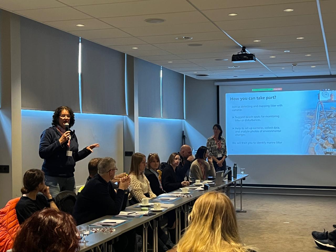
Getting people involved in mapping beach litter dynamics

My name is Natascha Oppelt, and I’m a Full Professor for Physical Geography at Kiel University, in the northernmost parts of Germany. As head of the Earth Observation and Modelling (EOM) group, I use satellite images and other remote sensing tools to study environmental changes, especially in the Arctic where I’ve been working since 2017.

My work combines different types of sensors and analyzes images taken over time to understand how environments are changing. Instead of just collecting data, I develop new methods to observe and understand what’s happening to our planet—from agricultural lands to water ecosystems. By bringing together various imaging technologies, I help create a more complete picture of environmental processes.

This approach is particularly valuable in remote Arctic regions where traditional monitoring is difficult. Within ICEBERG, I’m responsible for Tasks 1.11 and 2.1.1 focusing on automated litter monitoring.

Our goal is simple: give Arctic residents the means to map the debris on their own beaches while generating robust data for researchers and policymakers. Teachers, students and other volunteers help install equipment, retrieve images and discuss results—turning monitoring into hands on environmental stewardship.

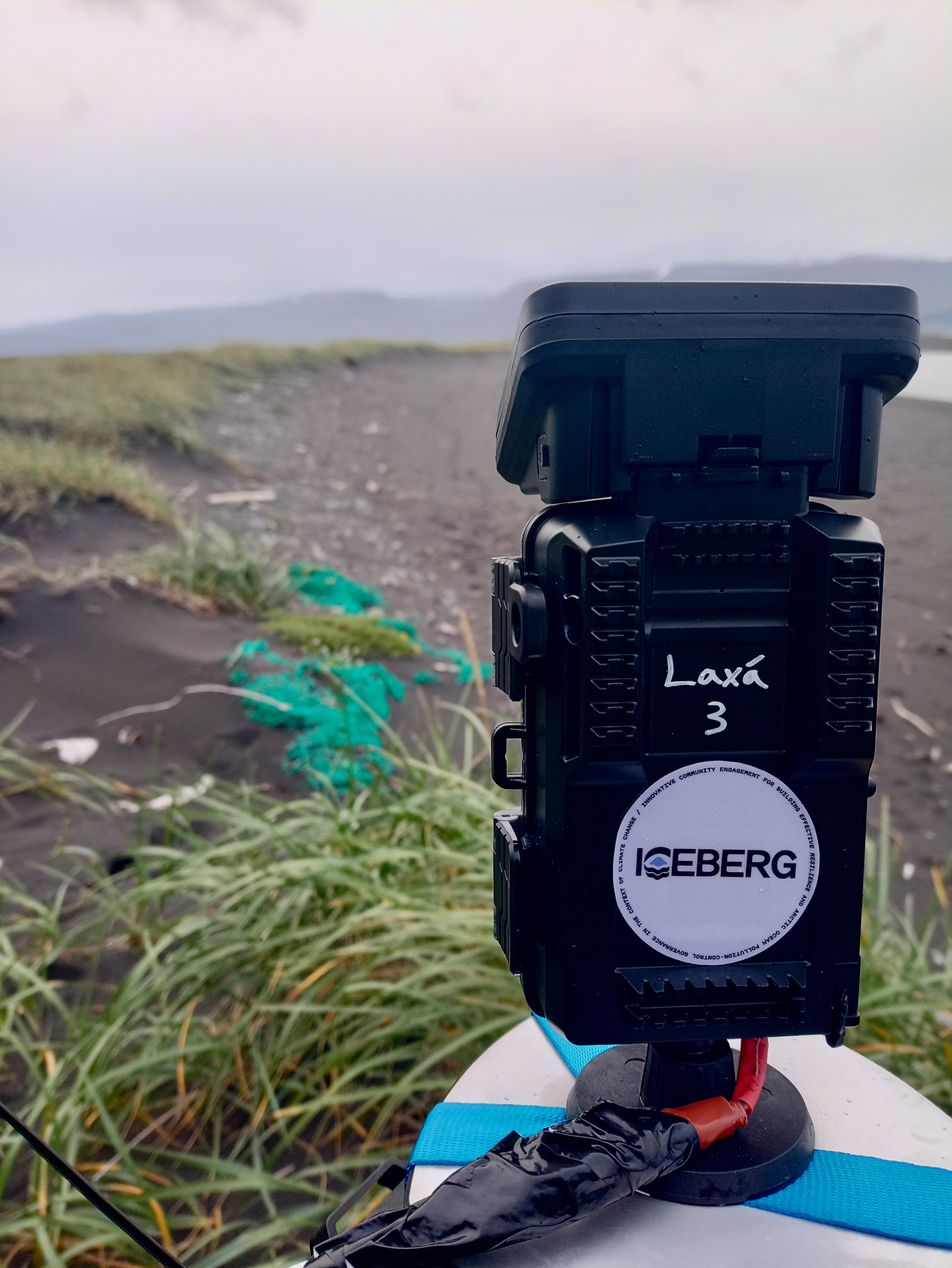
Why time-lapse cameras?

The Arctic is vast, remote, and often difficult to access, especially for regular scientific surveys. To overcome these challenges, ICEBERG combines time-lapse cameras and drones with the help of local residents and schools. These tools allow us to monitor beaches continuously and efficiently, even in places where people can’t always be present.

Time-lapse cameras automatically take pictures every hour—throughout the day and across seasons. This creates a visual record of how much litter washes ashore, how it moves, and how it changes over time.


A time-lapse camera on a rocky beach. A close-up of a time-lapse camera on a rocky beach. The camera has an ICEBERG sticker on it.

What do we do with the time-lapse cameras?

Setting up cameras in the Arctic is a team effort. I and my team work closely with local communities, teachers, and students to choose safe, strategic locations for the cameras. Local volunteers help install, check, and maintain the equipment, making sure it withstands harsh weather and wildlife curiosity.

The images collected are shared with the community and used to train computer programs (artificial intelligence (AI)) that can automatically identify and count different types of beach litter. This saves time and makes it possible to analyze thousands of photos efficiently. This means we don’t have to count every piece by hand.

Moreover, setting up these cameras gives local people a chance to join in real science work and see changes happening on their beaches over time. Teachers can also use our cameras and pictures to show students about beach pollution and how beaches naturally change. This helps kids learn about their local environment and how people affect it.

In a small conference room in Husavik, Natascha Oppelt conducts a consultation meeting for the local people.

Natascha introduces the camera approach at a community consultation meeting in Iceland. Photo: Helga Númadóttir.

Study Areas

Working alongside Apostolos Papakonstantinou from SciDrones, I engage directly with teachers and students from Indigenous and local communities in Iceland and Greenland.

What kind of data do we have until now, and what do we do with the data?

During our field campaign to Iceland last September, we already installed some cameras. They delivered photos until volunteers deinstalled them due to heavy snowfall in November. We had to learn that some beaches were not as polluted as we thought they would be, other cameras fell over due to stormy weather. Based on the experiences we made, we improved the hooks that fix the cameras onto the ground or rock.

Although the cameras take a picture only every hour to reduce the amount of data, we have to look through an immense number of photos. After the winter break, we will install several cameras in the upcoming month. Then we have to wait until autumn for the photos. Until then, we are using the images of the previous year to start developing our AI app.

“Our goal is simple: give Arctic residents the means to map the debris on their own beaches while generating robust data for researchers and policymakers.”

Looking ahead

While waiting for the photos, we use the photos of last summer to work on our AI app. This app can then be used by the teachers and students after ICBERG has ended. ICEBERG’s approach is about more than just monitoring. By involving local people and using cutting-edge tools, we’re building resilience and helping Arctic communities adapt to the combined pressures of pollution and climate change. The experience and knowledge gained will shape future policies and inspire similar efforts in other vulnerable regions.

These photos are the basis for an AI-based approach that will, at the end of the project, automatically identify larger pieces of all sorts of litter.

Text written by Natascha Oppelt.

Photos of the cameras installed at beaches in Iceland were taken by Victor Lion.

Read more and stay tuned

Read more about how ICEBERG uses drones to detect marine litter from a blog post written by Apostolos Papakonstantinou.

Stay tuned on ICEBERG’s ongoing research and latest updates by following our social media channels:


Subscribe to our newsletter and stay updated on the progress of the project.

Subscribe

Project Scientific Coordinator

Prof. Thora Herrmann
University of Oulu
thora.herrmann@oulu.fi

Co-coordinator, Project Manager

Dr Élise Lépy
University of Oulu
elise.lepy@oulu.fi

Communications

Marika Ahonen
Kaskas
marika.ahonen@kaskas.fi

Innovative Community Engagement for Building Effective Resilience and Arctic Ocean Pollution-control Governance in the Context of Climate Change

ICEBERG has received funding from the European Union's Horizon Europe Research and innovation funding programme under grant agreement No 101135130

Privacy Policy