Following Pollution Through the Arctic: ICEBERG’s Svalbard Fieldwork Wrap-Up
As the ICEBERG project enters its third year, we mark a key milestone with the completion of our natural sciences fieldwork in Svalbard. Over two field seasons, our researchers have collected marine litter and environmental samples across and around the archipelago. This work provides new insight into how pollution accumulates in ice, snow and near-shore coastal ecosystems and what this means for one of the world’s most fragile environments. In this blog post, researchers from forScience Foundation, ISP-CNR, and GEOMAR summarize their work and explain how the results will contribute to ICEBERG’s final outcomes.
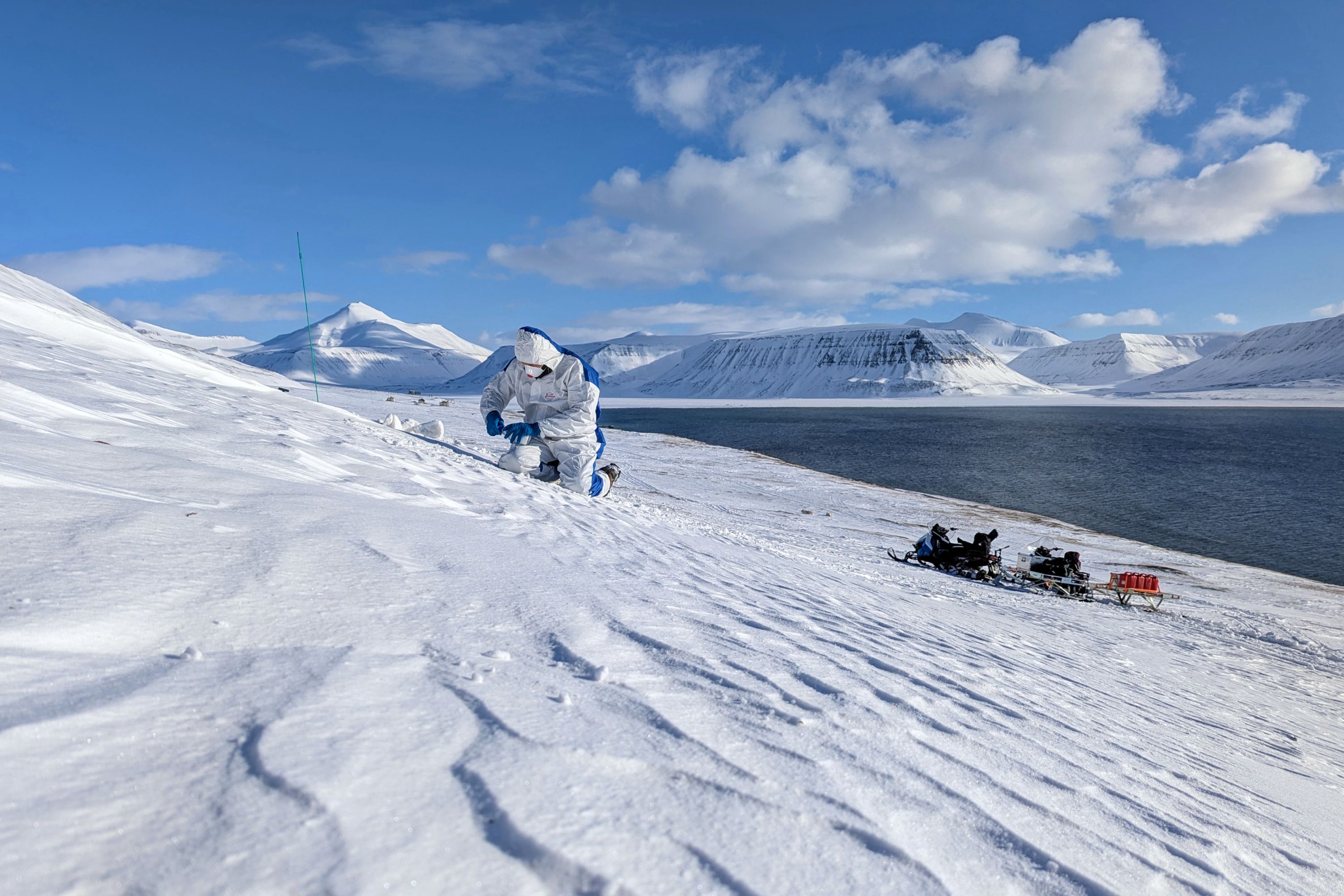
Collecting snow samples for heavy metal analysis in the vicinity of Longyearbyen, Svalbard. Photo credit: Barbara Jóźwiak, forScience Foundation
Tracing pollution pathways across land, sea and atmosphere
Stretching from remote coastlines to glaciers, towns, and open ocean, the fieldwork in Svalbard has formed a coordinated effort to understand the types, distribution and sources of pollution in the Arctic environment.
Over two fieldwork seasons in 2024 and 2025, the researchers have collected marine litter as well as soil, ice, snow, and water samples from remote coasts of Southern Spitsbergen (Sørkapp Land), the capital Longyearbyen and on the glaciers and fjords of Northern Spitsbergen in Ny-Ålesund.
“Through these activities, we aim to trace pollution pathways across land, sea and atmosphere,” explains Adam Nawrot from forScience Foundation.
Svalbard fieldwork in numbers:
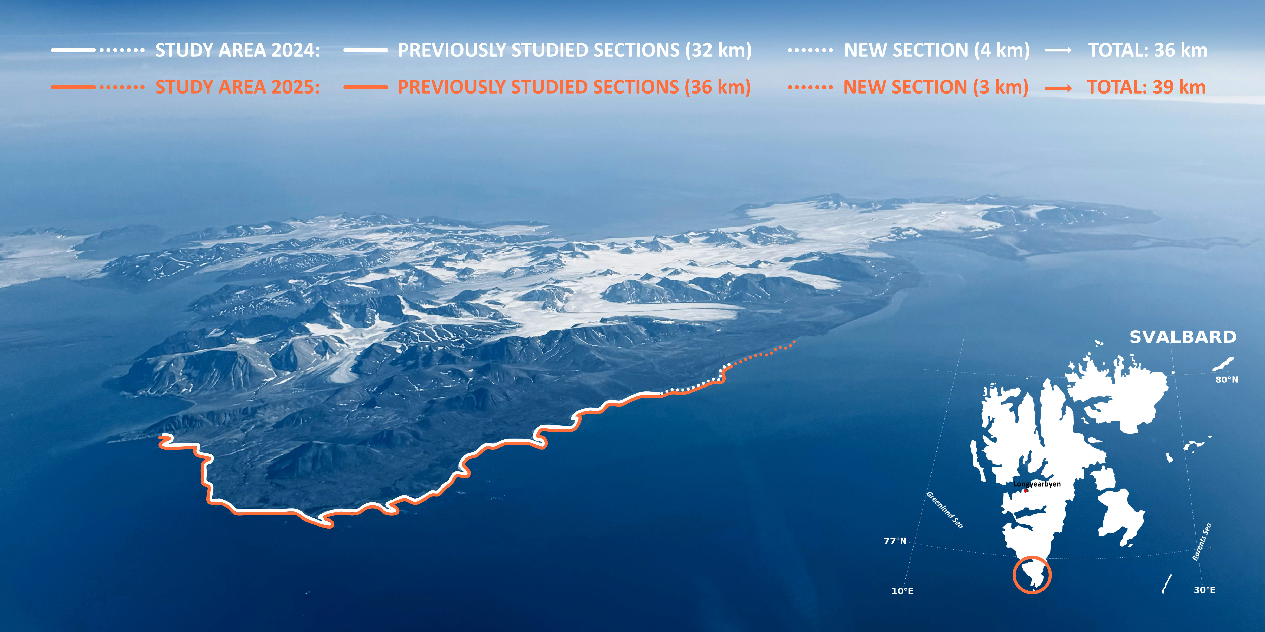
39 km of coastline cleaned and nearly 4700 kilograms of marine litter collected in Sørkapp Land
300 environmental samples collected to analyse for heavy metals around Longyearbyen and Sørkapp Land
469 snow samples around Ny-Ålesund to analyse for chemical contaminants
164 sediment samples and 6 sediment trap samples from Ny-Ålesund and Fram Strait to uncover the extent of organic chemicals and microplastics
93 plastic samples from incubation experiments and field deployments and 328 seawater samples to analyse for antibiotic resistance
Understanding marine litter and heavy metal contamination
One key component of the fieldwork focused on stranded marine litter. For two fieldwork seasons, the forScience Foundation team worked in Sørkapp Land, collecting and documenting nearly 4700 kilograms of marine litter from 39 continuous kilometres of some of the most inaccessible shores of the archipelago. Detailed item-level analysis is underway for a subset of collected litter, alongside chemical analysis of over 200 plastic samples to identify polymer types.
Research into stranded marine litter conducted in Svalbard by the forScience team involved a thorough clean-up of the entire study area. Background photo credit: Anita nita Horowska, forScience Foundation
“Arctic pollution differs fundamentally from marine litter at lower latitudes,” explains Barbara Jóźwiak from forScience Foundation.
“While beaches further south are dominated by recreational litter, such as cigarette butts and plastic packaging, the main issue on Arctic shorelines is items from industrial activities, mainly the fishing industry. This is an important distinction for designing effective solutions.”
Alongside marine litter, forScience also studied heavy metal contamination. More than 300 samples of freshwater, soil and snow were collected from remote areas in Sørkapp Land and sites influenced by human activity around Longyearbyen.
“From the South Spitsbergen National Park we obtain baseline levels of heavy metals,” Jóźwiak says. “By comparing these with samples from Longyearbyen and around, we can better understand how local infrastructure, transport and harbour activities influence contamination levels.”
Tracking local and long-range chemical pollution and microplastics through Arctic snow, meltwater and sediments
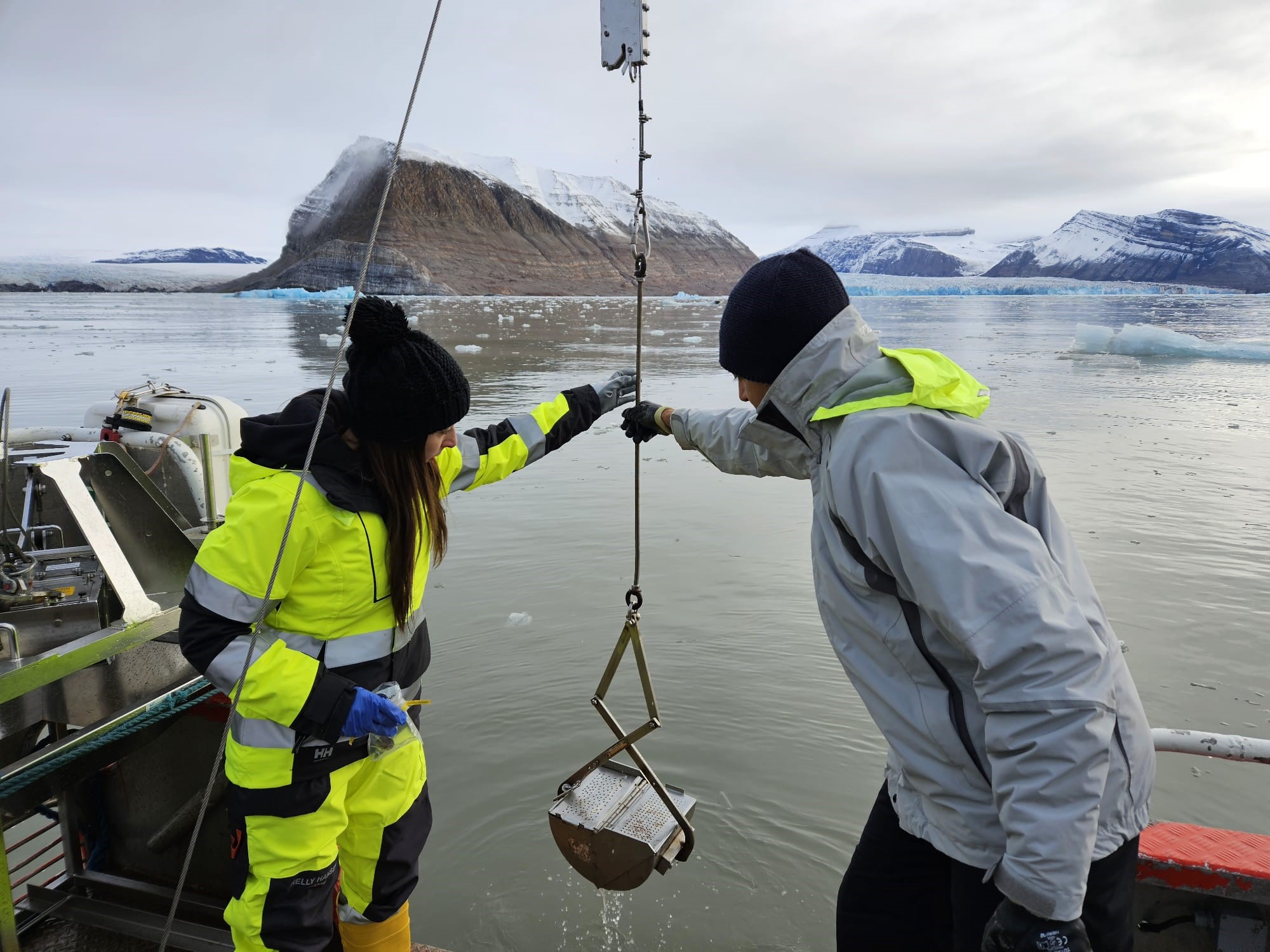
Retrieving a sediment grab from coastal Arctic waters. Photo credit: ISP-CNR
Another major research component aims to understand how chemical contaminants are transported, transformed, and stored across snow and ice, coastal waters, and marine sediments in the Arctic. This work focused on examining whether the pollution comes from local sources or long-range transport, and how climate-driven processes such as ice melt and Atlantification influence pollutant pathways.
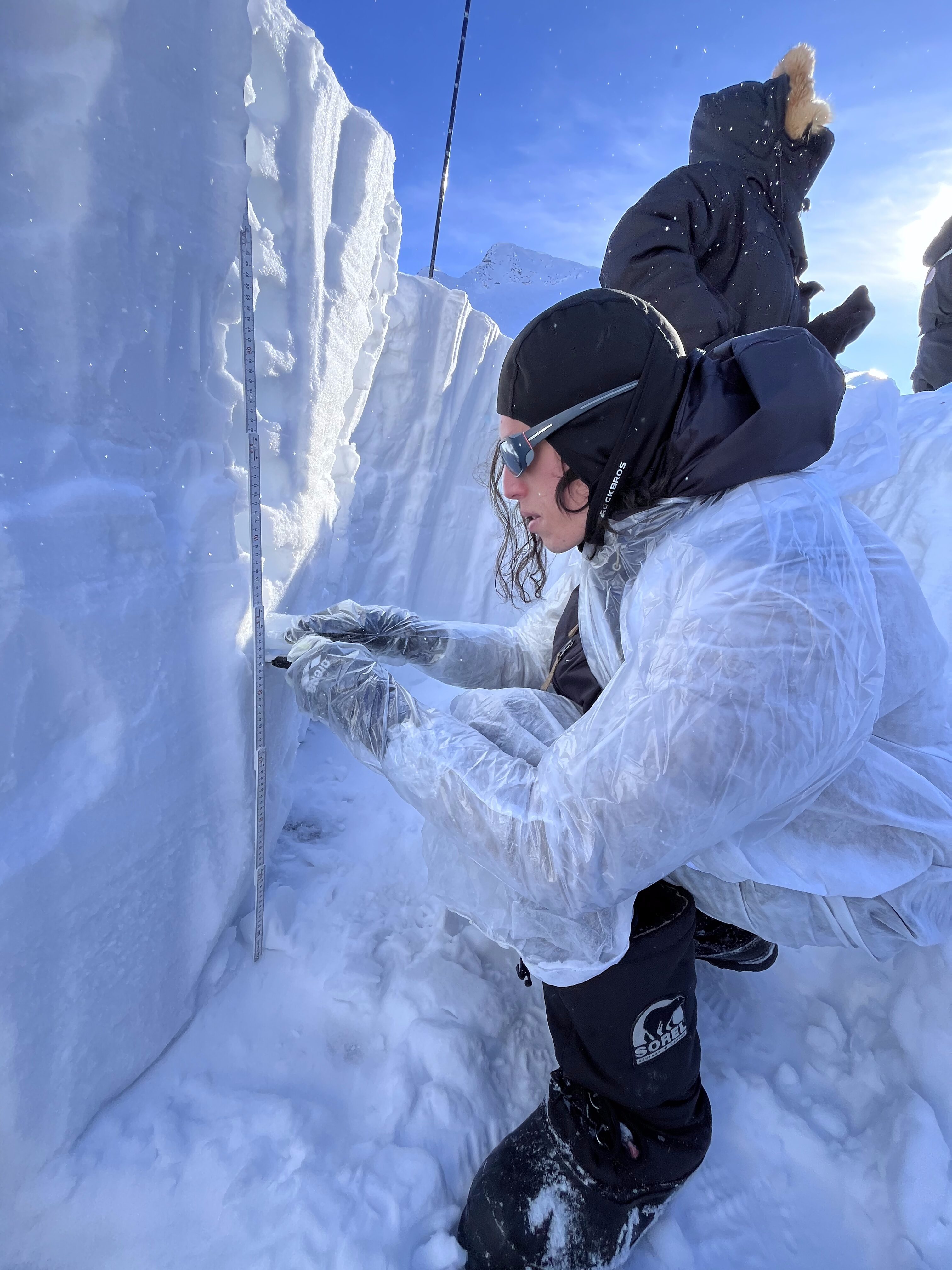
Collecting samples in Ny-Ålesund. Photo credit: Beatrice Ugelmo
Around Ny-Ålesund, researchers collected a total of 469 snow samples to investigate how contaminants are deposited from the air and stored in the cryosphere. The results show that snow can act as a temporary storage for a wide range of chemicals, which may later be released into the environment during melting periods (i.e. secondary emission), influencing freshwater systems and ecosystems downstream.
“Snow offers a unique window into long-range pollution. By analysing what is stored there, we can better understand how distant human activities leave chemical fingerprints in the Arctic,” explains Beatrice Ulgelmo from ISP-CNR.
In addition to snow sampling, ISP-CNR has also collected sediment samples and sediment traps in the fjords of Kongsfjorden and Krossfjorden. These samples are used to analyse the sinks and sources of microplastic pollution – as well as other persistent contaminants – and how they end up in phytoplanktons and this way to our food web.
Tracking Antimicrobial Resistance on Plastics in the Arctic Ocean
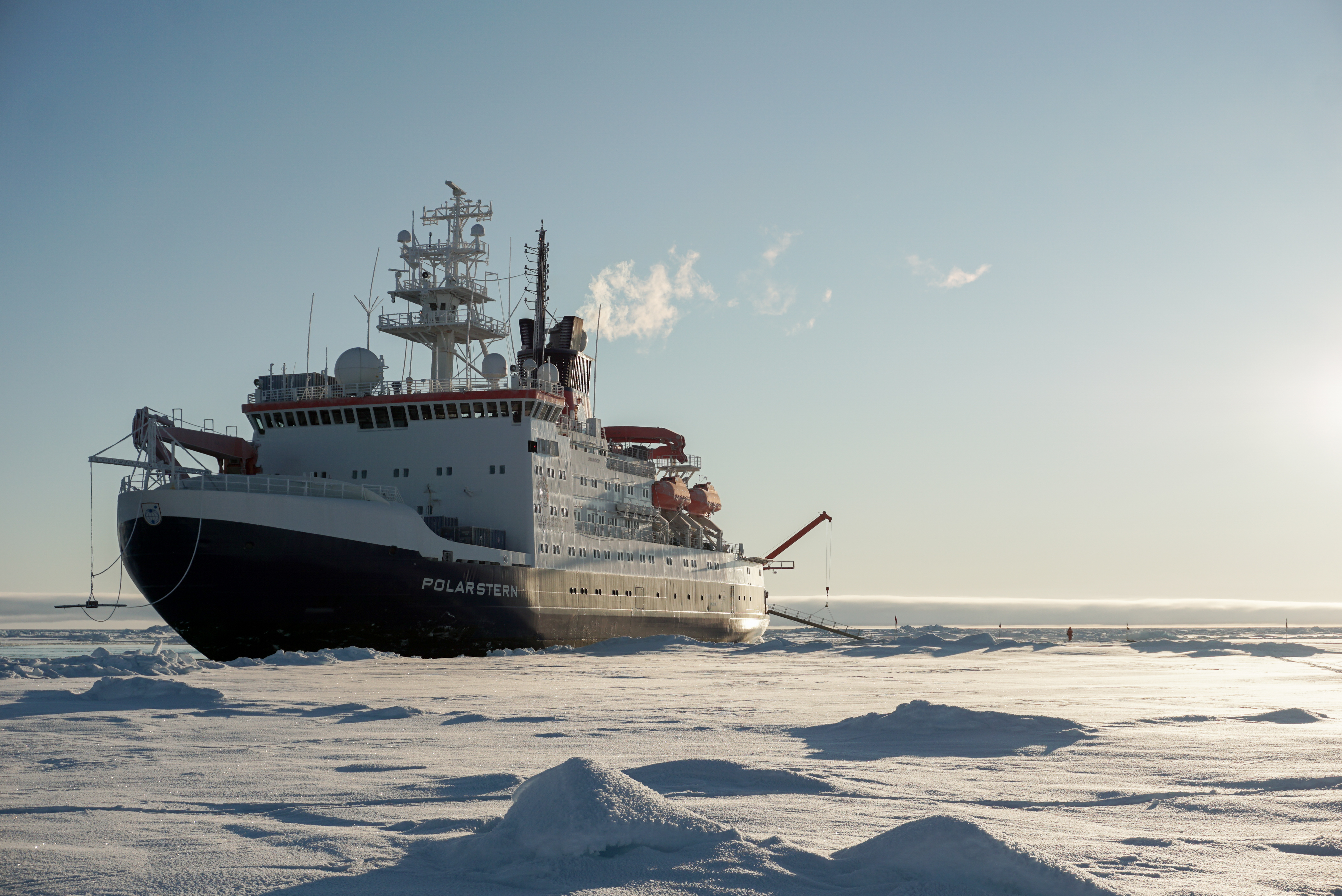
The natural science fieldwork extended from Svalbard into the open ocean in the East Greenland coast and the Fram Strait, the deep passage between Greenland and Svalbard that connects the Arctic Ocean with the North Atlantic. During several expeditions aboard the Polarstern research vessel, ICEBERG researchers collected samples and conducted incubation experiments to study micro- and macroplastics and the microbial communities that live on plastic surfaces in Arctic waters.
Polarstern research vessel. Photo credit: GEOMAR
Using advanced molecular and genomic methods, the team is exploring the role of plastic debris in providing novel habitats for potentially harmful microbes, including those linked with antimicrobial resistance.
“Plastics are more than just debris in the environment. They form new habitats for microbes, and understanding these communities is key to assessing the biological risks of plastic pollution in the Arctic,” explains Benjamin Pontiller from GEOMAR.
Now that the natural sciences fieldwork in Svalbard is completed, the focus moves from the Arctic to the laboratory. Samples collected across Svalbard and nearby regions are being analysed to better understand what they contain and what they tell us about pollution in the Arctic.
The Svalbard fieldwork is one piece of a larger puzzle. Results will be combined with findings from other ICEBERG field sites in Iceland and Greenland to build a broader picture of how pollution moves through Arctic environments across land, sea and atmosphere. Some sampling is still also taking place in Greenland and Iceland.
In the next phase, this knowledge will feed into scientific models, environmental risk assessments and policy-relevant outputs. The goal is simple: to turn detailed fieldwork into clear knowledge that can help protect the Arctic now, and in the future.
Stay tuned for more
Stay tuned on ICEBERG by subscribing to our newsletter and following us on social media: